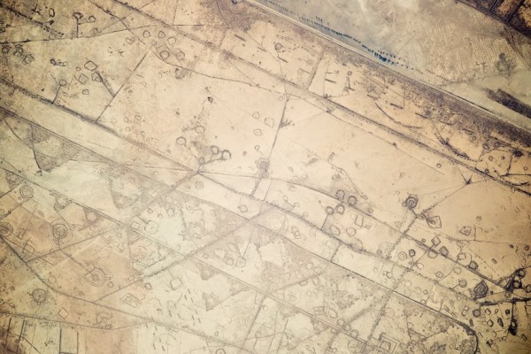
A picture shot from the International Space Station reveals footprints of the 1980s Iran-Iraq War in the region. The astronauts observing Earth have noticed markings around the Iran-Iraq border that at first were presumed to show oil fields. It has now been concluded that they are trenches, communication pathways and Iraqi soldier stations that remain visible after 26 years.
In the image, about 20 kilometres of the border between Iran and Iraq is clearly visible from the midpoint of the top stretching to the right side, and Iranian territory can be distinguished by its darker sand.
The image was reportedly taken in November of 2014 but has only now been released to the media in February 2015.
The International Space Station, which operates through the cooperation of 15 different countries, orbits about 350 kilometres above the Earth’s surface at a speed of 27,700 km/h, which means it circles the Earth 15 times a day.
It appears that the image corresponds to the movements and preparations for the Karbala 5 operation. On January 9, 1986 an operation led by Iran’s Revolutionary Guards Corps was launched to take Basra. It became a major episode in the eight-year war, causing many fatalities and becoming a prelude to the end of the war.


